Dial & Nippletop
Iterations of this hike have been planned and scrapped since July, with the latest one a proposed Colvin-Blake-Nippletop-Dial hike. The previous day’s over-hiking scrapped the 4-peak plan in favor of a more modest straight up-and-back over these two, allowing if nothing else an extra hour of sleep.
So a bit later than usual, 7:30 AM, we were walking from the Ausable Club parking lot towards the trailhead. Out of nowhere and completely unprovoked, a nasty kamikaze wasp attacked me, stinging me twice on the chin. I can only hope it died, because my face hurt all day.
We signed in to the trail at 7:49 AM and turned up the Leach trail shortly afterwards. This trail is short but steep nearly the whole way up until you hit the state land border, about a mile away. Thankfully it was soft underfoot, not the boulder hopping from the previous day, but Kathy & I still felt every uphill step more than usual.

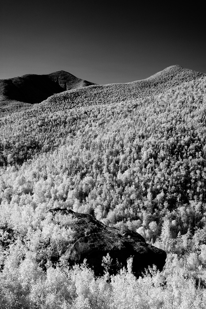
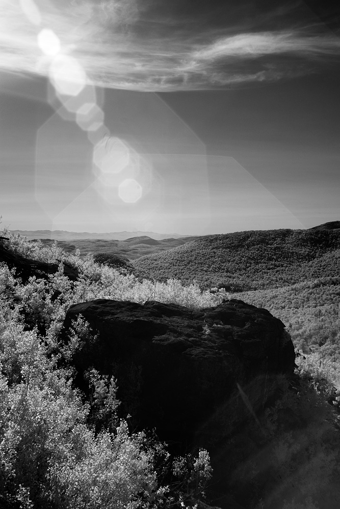
In addition to being soft underfoot the whole way, the top of the Leach trail seemed to be newly re-routed through a young grove of trees, which I’m told are the result of the 1999 fire. So too was what I felt provided the best views of the day, the bare rocky outcropping on Noonmark Mountain. Dominated by Dial and Nippletop just in front of you, the Great Range extended off to your right in profile.

A small, steep down followed by a relatively long uphill were the longest 0.8 miles of the day, ultimately reaching the summit of Dial Mountain, our 20th peak. Taking a small rest on the boulder atop Dial, my body finally squeezed out a concession, and I stashed my bag under the boulder for the jaunt up Nippletop.
Switching from the 18 pounds to a much smaller pack (just the essentials – lunch and a camera) – made a huge difference on the remaining climbs. From one of the vantage points on Dial you could clearly make out the route to Nippletop, going over three bumps along the way. With the both of us more tired than usual, knowing exactly what to expect made a huge difference, and the 2 miles from Dial to Nippletop seemed to go faster and easier than the 0.8 from Noonmark.
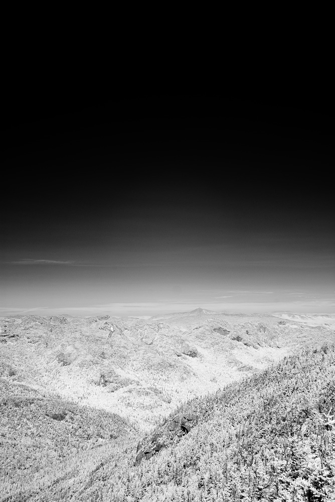
Abruptly coming to an end at the summit, Nippletop provided a view from a couple boulders on one side and over some trees on the other. Perhaps it was because the day before we had done Wright, Algonquin & Iroquois, or because we were treated to spectacular views on little ol’ Noonmark, but the views from Nippletop’s ledge were nothing spectacular. Not that the views, especially westward, weren’t good – it just wouldn’t be in my top 10, and I couldn’t imagine the small summit on a crowded summer day. As it was, we summited our 21st Adirondack High Peak, and we enjoyed a quick lunch and hurried back the way we came.

We were warned about having to climb back over Dial to re-trace our route up, but honestly there wasn’t much re-climbing at all. It seemed that it was mostly descending with steep but mercifully short climbs all the way back to Noonmark, and from there was 1.7 miles all downhill to Lake Road.
Keeping an eye out for bees, we made it back to the car before 4:30 PM. 21 down, 25 to go.


Photos taken with a Pentax*ist D & *ist DS (IR) cameras and Pentax-A 50mm f/1.2 & Pentax-FA*24mm f/2 lenses.
2012: 17 high peaks (+2 repeats) As of 9/13/12: 21 (out of 46) high peaks completed.
Our 2012 high peaks: Big Slide; the Wolfjaws & Armstrong; Marcy; Gothics & Sawteeth; Street & Nye; Phelps; Rocky Peak Ridge & Giant; Skylight & Gray; Wright, Algonquin, & Iroquois; Dial & Nippletop; Dix, Hough, S. Dix, E. Dix & Macomb
Edit: See: Our Path to 46.
M Shattan
July 19, 2014Thanks for this post and especially the photography. We just hiked these with Blake & Colvin and I used a link to your site in my letter.
http://thetreehouseletter.blogspot.com/2014/07/hiking-mt-colvin-blake-peak-nippletop.html
Hiking Mt. Colvin, Blake Peak, Nippletop, & Dial Mt. – TreeHouseLetter
February 22, 2022[…] * The closest thing I found to God’s Gate was on photographer Sean Carpenter’s website who also happens to hike in the Adirondacks. His photos are worth your time: Link to Sean Carpenter’s site. […]